segunda-feira, 5 de abril de 2010

Coastal Chalk Cliff Instability (Geological Society Engineering Geology Special Publication) (No. 20)


Coastal Chalk Cliff Instability (Geological Society Engineering Geology Special Publication) (No. 20)Geological Society of London ISBN: 1862391505 2006-01-30 PDF 173 pages 7 Mb
Most of the rocky coastlines around the world are subject to active erosion processes. Because of the growing hazard to local communities from coastal cliff retreat, it is necessary to investigate where, when and how cliffs collapse. The results of these studies are vital for the planners and local authorities responsible for safety and access to cliffs and beaches.This volume focuses on the coastal chalk cliffs of the English Channel, where a multidisciplinary approach has been used to understand active coastal cliff recession. The book is organized around three main themes: the geological factors controlling cliff instability, the marine parameters influencing coastal erosion and the use of some new tools for hazard assessments. This book will be of use to academics and professionals working on rocky shores, with an interest in sedimentary geology, stratigraphy, tectonics, geomorphology, engineering geology, coastal engineering and GIS.

Basic Geological Mapping


Basic Geological MappingWiley ISBN: 047084986X January 16, 2004 English PDF 196 pages 3.37 Mb
Geological mapping cannot be taught by lectures or in a laboratory, it must be learnt in the field. Now in its fourth edition, this is a basic guide to field techniques in mapping geology. Concise and pocket sized so that it can be carried in the field for instant reference.

Dating and Duration of Fluid Flow and Fluid-Rock Interaction (Geological Society Special Publication No. 144)


Dating and Duration of Fluid Flow and Fluid-Rock Interaction (Geological Society Special Publication No. 144)Publisher: Geological Society of London ISBN: 1862390193 edition 1998 PDF 300 pages 61,6 mb
Fluid flow is fundamental to many geological processes, including the development of natural resources of hydrocarbons, ore deposits and water. Modelling of these processes requires information on the timing of fluid flow events and the interaction of fluids with surrounding rocks. In addition to isotopic methods, a diversity of approaches has been developed to assess the timing of events, including palaeomagnetism, fission track analysis and fluid inclusion studies. Many techniques also provide information on the duration of fluid flow events.The papers in this volume represent the range of approaches to determine the dating and duration of fluid flow events and fluid-rock interaction.The first overview of methods of dating fluid flow; examples of commercial application of dating methods; explanations of methodology; suitable for advanced teaching and with extensive bibliographies. Readership: This volume will be of interest to geologists in the hydrocarbon and minerals industries and in academia, and to geochemists and hydrogeologists.

Geological Prior Information: Informing Science and Engineering


Geological Prior Information: Informing Science and EngineeringPublisher: Geological Society of London ISBN: 1862391718 edition 2005 PDF 229 pages 27,7 mb
When faced with a scientific problem, researchers usually draw on both existing pertinent knowledge as well as collecting new data in order to construct an answer. Geological prior information is the term used to describe all previously existing knowledge of a geological nature. Examples of such information include field interpretations, process models, expert judgments and common assumptions, together with the uncertainties associated with each.

Recent Advances in Lower Carboniferous Geology (Geological Society Special Publication No. 107)


Recent Advances in Lower Carboniferous Geology (Geological Society Special Publication No. 107)Publisher: Geological Society of London ISBN: 1897799586 edition 1996 PDF 472 pages 69,9 mb
Rocks of Lower Carboniferous age are widely developed across Europe. Apart from their instrinsic geological interest, they are hosts to major Zn-Pb-Cu-Ba deposits in Ireland and Au-FeS2 deposits in the Iberian Pyrite Belt. Further, the Upper Palaeozoic rocks of Europe are increasingly becoming the target of oil and gas exploration.This book brings together in one volume advances over the last decade in several specialist subdisciplines of geology.
Please appreciate my work to rock these
links:

Imaging, Mapping and Modelling Continental Lithosphere Extension and Breakup (Geological Society Special Publication No. 282)


Imaging, Mapping and Modelling Continental Lithosphere Extension and Breakup (Geological Society Special Publication No. 282) Publisher: Geological Society of London ISBN: 1862392285 edition 2007 PDF 488 pages 51,9 mb
This book summarizes our present understanding of the formation of passive continental margins and their oceancontinent transitions. It outlines the geological, geophysical and petrological observations that characterize extensional systems, and how such observations can guide and constrain dynamic and kinematic models of continental lithosphere extension, break-up and the inception of organized seafloor spreading. The book focuses on imaging, mapping and modelling lithospheric extensional systems, at both the regional scale using dynamic models to the local scale of individual basins using kinematic models, with an emphasis on capturing the extensional history of the Iberia and Newfoundland margins. The results from a number of other extensional regimes are presented to provide comparisons with the North Atlantic studies; these range from the Tethyan realm and the northern Red Sea to the western and southern Australian margins, the Basin and Range Province, and the Woodlark basin of Papua New Guinea. All of these field studies, combined with lessons learnt from the modelling, are used to address fundamental questions about the extreme deformation of continental lithosphere.
Links

Anthony T. S. Ramsay, J. G. Baldauf , «A Reassessment of the Southern Ocean Biochronology (Geological Society Special Memoir, 18) »


Anthony T. S. Ramsay, J. G. Baldauf , «A Reassessment of the Southern Ocean Biochronology (Geological Society Special Memoir, 18) »Geological Society of London ISBN: 1862390274 1999 PDF 122 pages 10 Mb
The integrated approach applied in the study provides a reassessment of the stratigraphy previously established for the 18 holes that have been re-examined. The authors set out the current understanding of Southern Ocean biochronology and give a synthesis of biostratigraphical and polarity data from previous work. The volume will be a valuable reference for interpreting the palaeoceanography, climatic history and tectonic evolution of the Southern Ocean. It also provides a framework for dating oceanography and sedimentary events that are used as proxies for interpreting the glacial history of Antarctica. Paperback.

Intra-Oceanic Subduction Systems: Tectonic and Magmatic Processes (Geological Society Special Publication)


R. D. Larter, "Intra-Oceanic Subduction Systems: Tectonic and Magmatic Processes (Geological Society Special Publication)"Geological Society of London; illustrated edition (January 1, 2003) English 1862391475 352 pages PDF 37.92 MB
Recycling of oceanic plate back into the Earth's interior at subduction zones is one of the key processes in Earth evolution. Volcanic arcs, which form above subduction zones, are the most visible manifestations of plate tectonics, the convection mechanism by which the Earth loses excess heat. They are probably also the main location where new continental crust is formed, the so-called 'subduction factory'. About 40% of modern subduction zones on Earth are intra-oceanic. These subduction systems are generally simpler than those at continental margins as they commonly have a shorter history of subduction and their magmas are not contaminated by ancient sialic crust. They are therefore the optimum locations for studies of mantle processes and magmatic addition to the crust in subduction zones. This volume contains a collection of papers that exploit the relative simplicity of intra-oceanic subduction systems to provide insights into the tectonic, magmatic and hydrothermal processes associated with subduction.

Links
or

C. S. Bristow, H. M. Jol, "Ground Penetrating Radar in Sediments (Geological Society Special Publication) (No. 211)"


C. S. Bristow, H. M. Jol, "Ground Penetrating Radar in Sediments (Geological Society Special Publication) (No. 211)"Geological Society of London (January 1, 2003) English 1862391319 330 pages PDF 34.83 MB
Ground penetrating radar (GPR) is transforming the way earth scientists and engineers describe and interpret near-surface sedimentary environments in the field. Because of recent advances in equipment, GPR now provides continuous, high-resolution data that other geophysical investigative tools cannot achieve. GPR has proven useful in a wide array of environmental, geological, and engineering applications. Included in this book are practical guidelines for data collection and interpretation, from antennae configurations to sequence stratigraphy, together with new advances such as vertical radar profiles and 3-D GPR imaging for hydrocarbon reservoir modeling, designed to assist new and veteran users to get the most from GPR. Case studies in this book detail GPR investigations in a wide array of sedimentary environments including alluvial fans, braided rivers, spits, beaches, sand dunes, lakes, bogs, and floodplains. Examples of GPR investigation applied to stratigraphic correlation problems in Holocene, Pleistocene, and ancient sediments; hydrocarbon reservoir modeling; and detection and mapping of contaminants, reservoir infilling, land mines, and fault displacements are included.

Links

Flow Processes in Faults And Shear Zones (Geological Society Special Publication)


Flow Processes in Faults And Shear Zones (Geological Society Special Publication)By G. I. AlsopPublisher: Geological Society of London 2004 379 Pages ISBN: 186239153X PDF 46.23 MB

Faults and their deeper level equivalents, shear zones, are localized regions of intense deformation within the Earth. They are recognized at all scales from micro to plate boundary, and are important examples of the nature of heterogeneous deformation in natural rocks. Faults and shear zones are significant as they profoundly influence the location, architecture and evolution of a broad range of geological phenomena. The topography and bathymetry of the Earth's surface is marked by mountain belts and sedimentary basins which are controlled by faults and shear zones. In addition faults and shear zones control fluid migration and transport including hydrothermal and hydrocarbon systems. Once faults and shear zones are established, they are often long-lived features prone to multiple reactivation over very large time-scales. This collection of papers addresses lithospheric deformation and the rheology of shear zones, together with processes of partitioning and the unravelling of fault and shear zone histories.
Download

Radioactive Waste Management Considering Timescales in the Post-closure Safety of Geological Disposal of Radioactive Waste


Radioactive Waste Management Considering Timescales in the Post-closure Safety of Geological Disposal of Radioactive WasteOrg. for Economic Cooperation & Development ISBN: 9264060588 2009-03-24 PDF 164 pages 3 Mb
A key challenge in the development of safety cases for the deep geological disposal of radioactive waste is handling the long time frame over which the radioactive waste remains hazardous. The intrinsic hazard of the waste decreases with time, but some hazard remains for extremely long periods. Safety cases for geological disposal typically address performance and protection for thousands to millions of years into the future. Over such periods, a wide range of events and processes operating over many different timescales may affect a repository and its environment. Uncertainties in the predictability of such factors increase with time, making it increasingly difficult to provide definite assurances of a repository's performance and the protection it may provide over longer timescales. Timescales, the level of protection and the assurance of safety are all linked. Approaches to handling timescales for the geological disposal of radioactive waste are influenced by ethical principles, the evolution of the hazard over time, uncertainties in the evolution of the disposal system (and how these uncertainties themselves evolve), and the stability and predictability of the geological environment. Conversely, the approach to handling timescales can affect aspects of repository planning and implementation including regulatory requirements, siting decisions, repository design, the development and presentation of safety cases and the planning of pre- and post-closure institutional controls such as monitoring requirements. This is an area still under discussion among NEA member countries. This report reviews the current status and ongoing discussions of this issue.

Committee on Geological and Geotechnical Engineering in the New Millennium, “Geological and Geotechnical Engineering in the New Millennium”


Committee on Geological and Geotechnical Engineering in the New Millennium, “Geological and Geotechnical Engineering in the New Millennium” National Academies Press 2006 ISBN: 0309100097 222 pages PDF 33,5 MB
About the AuthorCommittee on Geological and Geotechnical Engineering in the New Millennium; Opportunities for Research and Technological Innovation, Committee on Geological and Geotechnical Engineering, National Research Council

Sumatra: Geology, Resources and Tectonic Evolution (Geological Society Memoirs, No. 31)


Sumatra: Geology, Resources and Tectonic Evolution (Geological Society Memoirs, No. 31)Publisher: Geological Society of London ISBN: 1862391807 edition 2005 PDF 300 pages 47,8 mb
This volume provides the first comprehensive account of the geology of Sumatra since the masterly synthesis of van Bemmelen (1949). Following the establishment of the Geological Survey of Indonesia, after WW II, the whole island has been mapped geologically at the reconnaissance level, with the collaboration of the geological surveys of the United States and the United Kingdom. The mapping programme, completed in the mid-1990s, together with supplementary data obtained by academic institutions and petroleum and mineral exploration companies, has resulted in a vast increase in geological information, which is summarized in this volume. The synthesis of structural controls on sedimentation and magmatism during the tectonic evolution of Sumatra since the late Palaeozoic has provided a background for the formation of economic deposits of metallic minerals, coal, oil and gas. The volume provides a sound basis for future geological research and for the exploration of the energy and mineral resources of the island.

D. G. Gee and R. A. Stephenson, «European Lithosphere Dynamics - Memoir no 32 (Geological Society Memoirs) (No. 32) »


D. G. Gee and R. A. Stephenson, «European Lithosphere Dynamics - Memoir no 32 (Geological Society Memoirs) (No. 32) »Geological Society Publishing House ISBN: 1862392129 2006 PDF 668 pages 58 Mb
Europe provides an outstanding field laboratory for studying lithospheric processes through time, for tracing the tectonic evolution of crust and mantle from the present far back into the early Precambrian. Two things are particularly striking: the importance of plate tectonics during the Phanerozoic and through the Proterozic into the Archeaen, and the significance of tectonic inheritance, older structures and rheologies guiding the younger evolution. 'European Lithosphere Dynamics' grew out of a major European Science Foundation programme, EUROPROBE, with participation of many hundreds of Earth scientists from all over Europe. The main research activities focused on specific target areas and involved integration of geological, geophysical and geochemical methods. Defining surface-depth relationships was a prerequisite for interpretation of the processes, present and past, responsible for the formation of the lithosphere. This Memoir addresses the major features of the European lithosphere and is aimed at giving the reader an overview of their development and growth during three billion years of Earth history.
Download

sexta-feira, 2 de abril de 2010

Volcanic Degassing (Geological Society Special Publication) (No. 213)


Geological Society Publishing, "Volcanic Degassing (Geological Society Special Publication) (No. 213)"
Geological Society of London (January 1, 2003) | English | 186239136X | 420 pages | PDF | 42.21 MB

Humans have long marvelled at (and feared) the odorous and colourful manifestations of volcanic emissions, and, in some cases, have harnessed them for their economic value. The degassing process responsible for these phenomena is now understood to be one of the key factors influencing the timing and nature of volcanic eruptions. Moreover the surface emissions of these volatiles can have profound effects on the atmospheric and terrestrial environment, and climate. Even more fundamental are the relationships between the history of planetary outgassing, differentiation of the Earth's interior, chemistry of the atmosphere and hydrosphere, and the origin and evolution of life.
This book provides a compilation of 23 papers that investigate the behaviour of volatiles in magma, the feedbacks between degassing and magma dynamics, and the composition, flux, and environmental, atmospheric and climatic impacts of volcanic gas emissions.

Link 01

or

Link 02

Tectonic, Magmatic, Hydrotherma, & Biological Segmentation at Mid-Ocean Ridges (Geological Society Special Publication)


Tectonic, Magmatic, Hydrotherma, & Biological Segmentation at Mid-Ocean Ridges (Geological Society Special Publication) By C. J. Macleod
Publisher: Geological Society of London 1996-11-01 | 258 Pages | ISBN: 1897799721 | PDF | 6 MB

We now recognize that mid-ocean ridges are not simple, two-dimensional features, but are instead partitioned into morphologically distinct segments on a variety of scales. Variations in axial morphology reflect differences in the structure of the magma reservoirs and in the nature of mantle upwelling beneath the ridge. Segment ends may be starved of magma, and spreading accommodated by tectonic stretching as well as by magmatic accretion. The location of the magmatic heat source and the distribution of permeability within the segment strongly control the geometry of seawater circulation in the crust and locus of hydrothermal discharge. In turn, the mechanisms of faunal colonization of vent sites and the evolutionary history of vent organisms depend strongly upon the spatial distribution of black smoker vents and the hydrodynamics of dispersal of the vent fluids. Segmentation, therefore, plays a vital role in the inter-relationship between all tectonic, magmatic, hydrothermal and biological processes at mid-ocean ridges. The recent research presented in this book, much of it carried out under the aegis of the British mid-ocean ridge 'BRIDGE' programme, examines this inter-relationship with the aim of furthering our understanding of the causes and consequences ofridge axial segmentation.

Baixar


Modern Ocean Floor Processes and the Geological Record


Modern Ocean Floor Processes and the Geological Record (Geological Society Special Publication) By Robert A. Mills
Publisher: Geological Society of London 1998-12-01 | 303 Pages | ISBN: 1862390231 | PDF | 24 MB

This volume considers the geological processes at and biological colonization of, deep ocean spreading centres from both a modern, for example Mid-Atlantic Ridge, the East Pacific and the South West Indian Ridge, and an ancient perspective, such as in the UK, Cyprus, Turkey, Greece and the Urals.The book is one of the first attempts to bring together researchers from disciplines as diverse as geophysics and biology studying modern active hydrothermal systems and the fossilized remains of long-extinct hydrothermal systems that are now locked in the geological record.By using new knowledge of how hydrothermal systems function we can aid the understanding and prediction of mineral deposits now found on land.


The Future of Geological Modelling in Hydrocarbon Development - Special Publication no 309

The Future of Geological Modelling in Hydrocarbon Development - Special Publication no 309
Geological Society of London | January 15, 2009 | English | ISBN: 1862392668 | 225 pages | PDF | 7.95 MB

The 3D geological model is still regarded as one of the newest and most innovative tools for reservoir management purposes. The computer modelling of structures, rock properties and fluid flow in hydrocarbon reservoirs has evolved from a specialist activity to part of the standard desktop toolkit. The application of these techniques has allowed all disciplines of the subsurface team to collaborate in a common workspace. In today's asset teams, the role of the geological model in hydrocarbon development planning is key and will be for some time ahead.

Myth and Geology - Special Publication no 273 (Geological Society Special Publication)


L. Piccardi and W. B. Masse; Editors, "Myth and Geology - Special Publication no 273 (Geological Society Special Publication)"
Publisher: Geological Society of London | 2007 | ISBN 1862392161 | PDF | 346 pages | 13.4 MB

This book is the first peer-reviewed collection of papers focusing on the potential of myth storylines to yield data and lessons that are of value to the geological sciences. Building on the nascent discipline of geomythology, scientists and scholars from a variety of disciplines have contributed to this volume. The geological hazards (such as earthquakes, tsunamis, volcanic eruptions and cosmic impacts) that have given rise to myths are considered, as are the sacred and cultural values associated with rocks, fossils, geological formations and landscapes. There are also discussions about the historical and literary perspectives of geomythology. Regional coverage includes Europe and the Mediterranean, Afghanistan, Cameroon, India, Australia, Japan, Pacific islands, South America and North America. Myth and Geology challenges the widespread notion that myths are fictitious or otherwise lacking in value for the physical sciences.

The Geological Concept of Mountains in the Holy Qur'an" by Zaghlul R. El-Naggar

"The Geological Concept of Mountains in the Holy Qur'an" by Zaghlul R. El-Naggar
Muslim World League Press | 1992 | ISBN: 0962723622 | 57 pages | PDF | 5 Mb

The study presented in this publication attempts to identify some of the relationships between recent findings in the field of geology and the meaning of some passages in the Qur'an. Some of these passages, which were revealed about 14 centuries ago,expressed certain geological facts, and it is only through some of the most recent geological findings of this century that these facts have become scientifically recognized. Other passages which contain indications of geological concepts are analyzed for additional details and explanations in this field.


The information in this study should be of great interest to both the Muslim and non-Muslim. It serves to strengthen the faith and to encourage the development of more scientific knowledge, and it adds a new dimension and perspective to geological research.
Author is considered an eminent scholar in the field of geology and has many publications, as well as participation in numerous conferences in his area. In this particular booklet, he analyzes in great detail a number of findings in geology and applies them directly to the understanding of Qur'anic passages which refer to the same subject.
The reader will find this material to be greatly stimulating, interesting and inspiring.

quinta-feira, 25 de março de 2010

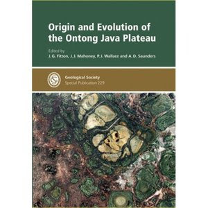
Origin And Evolution of the Ontong Java Plateau

O Cretáceo submarino Ontong Java Plateau, no oeste do Oceano Pacífico, é o mais volumoso do mundo grandes províncias ígneas (lábios), e representa o maior evento magmático conhecido na Terra. Lábios são os produtos de vulcanismo basáltico numa escala e com uma taxa de efusão não visto na Terra no tempo presente, e sua formação pode ter tido um impacto significativo no clima da Terra e da biosfera. A explicação atualmente favorecida para a formação do LIP é a descompressão rápida e derretimento do manto anormalmente quente na cabeça dos recém-ascendido manto de plumas. Este volume resume os resultados de pesquisa visando principalmente a pena testar a hipótese principal para a formação do Java Ontong Planalto, e apresenta os resultados de estudos integrados na sequência de perfuração porão recente no planalto do Ocean Drilling Program.

baixar


Aspects of Tectonic Faulting

Este livro oferece uma visão geral das abordagens modernas à dinâmica da tectônica de falha. As contribuições foram selecionados trabalhos que foram apresentados em uma conferência organizada por ocasião do aniversário do Georg Mandl 70. O entendimento da geologia estrutural e mecânica da falha tectónica que sempre esteve no centro de seu interesse estava bastante adiantado pelo trabalho Mandl's. Os tópicos abordados são: fluxo de partículas de modelagem, técnicas de modelagem analógica, em larga escala os modelos tectônicos, o início da falha acima evaporitos, um crescimento dinâmico desencadeamento de sismos, de zonas de falha inicialmente segmentado.

Baixar

Apostila Estrutural - UFPA


Este trabalho representa a reunião de diversas notas de aula da disciplina Geologia Estrutural, oferecida pelo Departamento de Geologia do Centro de Geociências da Universidade Federal do Pará, ministrada pelos autores nos útimos anos.

baixar

Confined Turbidite Systems (LINK FIXED)


Os trabalhos apresentados aqui oferecem uma perspectiva global, que é abrangente em termos de abordagem, bem como local, inclusive contrastantes opiniões e estudos de casos de afloramento, subsolo, moderna e experimental de sistemas. Este livro será de uso, tanto para os geólogos acadêmica e aos profissionais de geociências na indústria de lidar com a caracterização / modelagem de reservatórios de águas profundas clásticos.

Esta publicação surgiu de uma crescente apreciação da medida em que o desenvolvimento de sistemas deposicionais turbidíticos é fundamentalmente afetado por bacia, a topografia do fundo. Em muitos sistemas turbidíticos e reservatórios de hidrocarbonetos turbidíticos, os padrões de deposição foram moderadamente a fortemente limitado por pré-pistas existentes; fãs, assim, "submarino" pode estar longe de ser em forma de leque, onde constrangidos por significativas características batimétricas. Este volume examina aspectos de dispersão e acumulação de sedimentos nos sistemas de águas profundas, onde a topografia do fundo do mar, tem exercido um controle decisivo sobre o depósito, e explora os controles associados sobre a arquitetura de reservatórios de hidrocarbonetos e heterogeneidade.

Baixar link 01


Baixar link 02


Senha: gigle. ws

Periglacial and Paraglacial Processes and Environments (Geological Society Special Publication, 320)

Ambientes folgada e paraglacial, localizadas fora margens de gelo, mas respondendo a forçantes climáticas semelhantes, são fundamentais para identificar os efeitos das alterações climáticas sobre o sistema Terra. Esses ambientes são remanescentes de processos de Terra fria e por isso são mais sensíveis ao aquecimento global. Alterações na distribuição e espessura do permafrost em interiores continentais têm implicações para a estabilidade do ecossistema e paisagem. Ambientes periglaciários Alpine estão experimentando rockfall aumentou e movimento de massa, levando ao rock geleira instabilidade e liberação de sedimentos para os rios a jusante. Por sua vez, estas impacto paisagem efeitos sobre os riscos naturais e as actividades humanas nestes sensível e geologicamente transitória ambientes.

Monografias neste volume explorar algumas destas questões inter-relacionadas em estudos de campo da Europa, América do Norte e Ásia. O volume será de interesse para geomorfologistas, modeladores, gestores ambientais, planejadores e engenheiros que trabalham na paisagem, mudanças climáticas e ambientais em áreas periglacial e paraglacial.

Baixar

The Proto-Andean Margin of Gondwana

A história geológica do Paleozóico ocidental América do Sul tem sido o foco de interesse internacional intensa nos últimos anos. Este livro reúne pesquisas multidisciplinares e artigos de revisão sobre a geologia Paleozóico Inferior do Sierras Pampeanas eo Precordillera do Centro-Oeste da Argentina. Trata-se da fase final de montagem do supercontinente de Gondwana e um período de interação tectônica com Laurentia (o continente norte-americano de hoje). As provas para o crescimento desta parte da margem de Gondwana do final do período Neoproterozóico é apresentado em termos de estratigrafia, paleontologia, petrologia ígnea, geocronologia e geoquímica e tectônica hipótese rival são criticamente comparados.

Baixar

Volcanism Associated With Extension at Consuming Plate Margins


Geocientistas precisam se familiarizar com o characteristicsof movimentos de placa real. A popular, a tese atual relaciona thestate de estresse com o grau de acoplamento das duas convergentplates. Recent dois tridimensional, modelagem de elementos finitos hasdemonstrated como o estresse no prato primordial é extremamente dependente do tempo na zona de subducção é bloqueado (highdegree isto é de engate) ou desbloqueado. Assim, o stressregime compressão ocorre em sistemas fechados, e strees extensional em unlockedsystems; um gradiente de compressão no fore-arc para extensionin de back-arc é dito para caracterizar system.However parcialmente bloqueada, os estudos do campo de tensão em casos reais (moderno arcregions) claramente indicam a prevalência de subhorizontais extensionorientated quase perpendicular ao arco. Implícito nas observações thesereal é a sugestão de que salienta engate placa resultingfrom ou não são transmitidos ao volcanicarc, ou então bloqueado zonas de subducção são incomuns e extensionmay ser o modo normal de comportamento.

A lógica e as provas de extensão e coevo margens placa volcanismat consumir é apresentado. Usando histórias principalmente Cenozoiccase para arcos margem oceânicas e continentais, structuralevidence é apresentado, o que demonstra que o vulcanismo íntimo sistemas de arco é contemporânea com falhamentos normais andsubsidence como um caso geral. Representativa, moderna define geochemicaldata são fornecidos e integrados em um discussionfor petrológicos cada caso clínico. O Pacífico Ocidental, hoje amplamente regardas um tipo de área para o estudo dos processos de margem convergente de placas, é especialmente bem representados. Também está incluído evidencefrom menos comumente insvestigated regiões, onde subducção hasceased ou já não é óbvio, mas uma associação com um arcis inequívoca. Por este meio, espera-se que este volumecontains uma amostra representativa seção de extensão Pesquisas de actuais vulcanismo de arco relacionados em sentido lato, e thatit vai estimular mais discussões e estudos sobre a complextectonics e petrologia das margens placa covergente.

Baixar link 01

Baixar link 02


Deformation Mechanisms, Rheology and Tectonics: From Minerals to the Lithosphere

Este livro é composto por 18 trabalhos sobre os mecanismos de deformação, reologia e tectônica. As principais abordagens incluem deformação rock experimental, análise microestrutural, estudos de campo estrutural, analógico e modelagem numérica. Novos resultados sobre vários temas são apresentados, que vão desde a deformação dúctil frágil e de grãos em larga escala a litosfera mecanismos de escala.O volume contém trabalhos de revisão sobre alguns dos principais temas atuais, tais como a reologia da litosfera manto e os mecanismos de exumação de unidades de alta pressão tectônica, bem como trabalhos de pesquisa na análise cinemática e mecânica de deformação de rochas e afins novas técnicas. Várias contribuições ressaltar a crescente capacidade e desejo de investigadores para reforçar os laços entre a pequena escala mecanismos físicos e placas em larga escala.O volume será de interesse para os investigadores académicos e industriais nas áreas de geologia estrutural, as interações entre metamorfismo, fluidos e deformação, e em grande escala de processos tectônicos.

Análise Estrutural e Síntese: Um Curso de Laboratório em Geologia Estrutural


Esta amplamente utilizada, bem legível de introdução à análise estrutural foi projetado especificamente para apoiar o trabalho de laboratório dos alunos de graduação nos cursos de geologia estrutural.A nova edição terceiro inclui:Novo e exercícios alterada e os valores reformulado para melhorar a clareza Um único fold-out mapa do Creek Bree Quadrangle - um local mítico usado para ajudar os estudantes a analisar os vários aspectos das estruturas geológicas expostas dentro deste quadrado e, finalmente, a desenvolver uma grande sínteseA user-friendly espiral de ligação ideal para o trabalho no laboratório ou no campo.

West Gondwana: Pre-Cenozoic Correlations across the South Atlantic Region


Alguns estudos de 75 anos após a obra visionária de Wegener e du Toit, Neoproterozóico às correlações Mesozoic geological entre América do Sul e África são reexaminados à luz das placas tectônicas e investigação geológica moderna (estruturais e metamórficas, estratigráfica, geoquímica, geocronologia e paleomagnetismo).O livro apresenta duas revisões e novas pesquisas relacionadas às origens comuns Gondwana de países que enfrentam-se em todo o Atlântico Sul, especialmente Brasil, Argentina, Camarões, Nigéria, Angola, Namíbia e África do Sul.Este é o primeiro tratamento completo para ser facilmente disponível em forma de livro. Abrange os elementos comuns das áreas pré-datados cratônica Gondwana, e como eles se reuniram na tarde e os tempos pré-cambrianas cambriana com a formação dos cintos Pan-African/Brasiliano orogênico (Dom Feliciano, Brasília, Ribeira, Damara, Gariep, Kaoko, etc.) O Paleozóico subseqüente compartilhada e registro sedimentar mesozóica (sistema de Karoo) antes de Gondwana break-up também é revisto.

Terrane Processes at the Margins of Gondwana


Este livro reúne uma série de revisões e trabalhos de pesquisa multidisciplinar que abranger o Australides do Orógeno Tasman do leste da Austrália para o Neoproterozóico e orogens paleozóicas da América do Sul, tendo na Nova Zelândia e Antártida ao longo do caminho. Trata-se da evolução da margem sul do Gondwana, que cresceu durante uma série de episódios de acreção terrane do Proterozóico atrasado com a fragmentação final em meados de vezes Cretáceo. Perspectivas globais são dadas por comparação com a margem norte do Gondwana paleozóicas e documentação de todo o mundo episódios de acreção terrane no Triássico, Jurássico e Cretáceo médio. O Tasmanides do leste da Austrália, e as histórias terrane da Nova Zelândia e sul da América do Sul.

Continents and Supercontinents


Para esse dia, há uma grande quantidade de controvérsia sobre onde, quando e como o supercontinents chamado - Pangea, Godwana, Rodínia, e Colômbia - foram feitas e quebradas. Continentes e quadros Supercontinentes que a controvérsia, dando todas as informações preliminares necessárias sobre a crosta continental como é formado, modificado e destruído, e que as forças de placas se movem. Ele também discute como esses processos afetam a composição da água do mar, o clima ea evolução da vida. Rogers e Santosh começar com um levantamento das placas tectônicas, e passam a descrever a composição, produção e destruição de crosta continental e oceânica, e mostrar que cratons ou conjuntos de cratons se tornou o primeiro verdadeiro continentes, cerca de um bilhão de anos após os primeiros crosta continental evoluiu. A parte central do livro concentra-se em supercontinents, começando com uma discussão sobre os tipos de cinturões orogênicos, distinguindo aqueles que se formaram pelo fechamento de uma bacia oceânica no cinto, e aqueles que se formaram pela deformação intracontinentais causada por tensões geradas em outros lugares. Esta informação permite a discriminação entre os modelos de formação do supercontinente de acreção de vários terrenos pequenos e reorganização de grandes blocos continentais de idade. Neste contexto leva a uma descrição da montagem e fragmentação dos supercontinents ao longo da história da Terra. O registro é o mais difícil de interpretar para o mais antigo supercontinente, Columbia, e também controverso para Rodínia, o supercontinente jovem que vem. As configurações padrão e de ruptura de Gondwana e Pangea são bem conhecidos, mas alguns aspectos de sua montagem são claras. O livro também descreve brevemente a história dos continentes após a dissolução da Pangea, e discute como as mudanças na composição da água do mar, o clima, e da vida podem ter sido afetados pelo tamanho e localização dos continentes e supercontinents.

An Introduction to Atmospheric Radiation - K. N. Liou.pdf


This Second Edition of An Introduction to Atmospheric Radiation has been extensively revised to address the fundamental study and quantitative measurement of the interactions of solar and terrestrial radiation with molecules, aerosols, and cloud particles in planetary atmospheres. It contains 70% new material, much of it stemming from the investigation of the atmospheric greenhouse effects of external radiative perturbations in climate systems, and the development of methodologies for inferring atmospheric and surface parameters by means of remote sensing. Liou's comprehensive treatment of the fundamentals of atmospheric radiation was developed for students, academics, and researchers in atmospheric sciences, remote sensing, and climate modeling.
Key Features*Balanced treatment of fundamentals and applications*Includes over 170 illustrations to complement the concise description of each
subject*Numerous examples and hands-on exercises at the end of each chapter.

terça-feira, 23 de março de 2010

Petroleum Geology of North Africa


Petroleum Geology of North Africa
Geological Society Special Publication vol.132
The Geological Society, London | 1998 | ISBN: 1862390045 | 449 pages | PDF | 250 Mb

The main objectives of this book are to increase the level of documentation towards that appropriate for such major petroleum provinces and to facilitate the application of analogues between North African countries and beyond.
This volume represents the first attempt at a compilation of the petroleum geology of North Africa, documenting a series of papers collected on the petroleum geology of Morocco, Algeria,Tunisia, Libya and the western part of EgySection

North Africa contains some 4% of the world’s remaining oil and gas reserves, and is now one of the most active exploration areas.
As the aims of this book are to encourage the use of analogues over national boundaries, papers we are grouped the geographically.

Contents
Section 1. Palaeozoic and Sub-Salt Regional Papers (PDF HQ 157 pages, 68mb):
Sect.1 ES Download • | • Sect.1 RS Download
Sect.1 iFi Mirror

• Introduction
• Palaeozoic petroleum systems of North Africa
• Exploration history of the Palaeozoic petroleum systems of North Africa
• Palaeozoic lithofacies correlatives and sequence stratigraphy of the Saharan Platform, Algeria
• Geology and hydrocarbon occurrences in the Ghadames Basin, Algeria, Tunisia, Libya
• An investigation of the thermal history of the Ahnet and Reggane Basins, Central Algeria, and the consequences for hydrocarbon generation and accumulation


Section 2. Palaeozoic Reservoirs and Fields (PDF HQ 45 pages, 19mb):
Sect.2 ES Download • | • Sect.2 RS Download
Sect.2 iFi Mirror

• Lower Palaeozoic reservoirs of North Africa
• Sedimentological and diagenetic controls on Cambro-Ordovician reservoir quality in the southern Hassi Messaoud area (Saharan Platform, Algeria)
• Controls on hydrocarbon occurrence and productivity in the F6 reservoir, Tin Fouyé-Tabankort area, NW Illizi Basin
• Sedimentological evolution of the Givetian-Eifelian (F3) sand bar of the West Alrar field, Illizi Basin, Algeria


Section 3. Mesozoic-Cenozoic Regional Papers (PDF HQ 94 pages, 43mb):
Sect.3 ES Download • | • Sect.3 RS Download
Sect.3 iFi Mirror

• Mesozoic and Cenozoic petroleum systems of North Africa
• Mesozoic rifting and basin inversion along the northern African Tethyan margin: an overview
• Late Permian to Recent magmatic activity on the African-Arabian margin of Tethys
• Tectonic controls on the petroleum geology of NE Africa
• An overview of the petroleum systems of Morocco

Section 4. Moesozoic Reservoirs and Fields (PDF HQ 96pages, 75mb):
Sect.4 ES Download • | • Sect.4 RS Download
Sect.4 iFi Mirror

• Application of fault seal analysis techniques in the Western Desert, Egypt
• Trap architecture of the Early Cretaceous Sarir Sandstone in the eastern Sirt Basin, Libya
• The influence of platform morphology and sea level on the development of a carbonate sequence: the Harash Formation, Eastern Sirt Basin, Libya
• Regional depositional setting and pore network systems of the El Garia Formation (Metlaoui Group, Lower Eocene), offshore Tunisia
• Basin evolution and deposition during the Early Paleogene in Tunisia

Section 5. The Atlas Fold Belt (PDF HQ 39 pages, 17mb):
Sect.5 ES Download • | • Sect.5 RS Download
Sect.5 iFi Mirror

• The thin-skinned style of the South Atlas Front in Central Algeria
• The structural evolution of the Zaghouan-Ressas Structural Belt, northern Tunisia
• Critical factors in the exploration of an Atlas intramontane basin; the Western Hodna Basin of northern Algeria


All pages in 1 PDF (PDF midQ 449 pages, 36mb):
v.132 ES Mirror • | • v.132 RS Download

terça-feira, 16 de março de 2010

The Boundaries of West African Craton


The Boundaries of the West African Craton - Special Publication no 297 (Geological Society Special Publication)Publisher: Geological Society of London edition 2008 PDF 536 pages 18,7 mb

The boundaries of rigid cratons can be affected by subsequent orogenic events, leading to 'metacratonic' characteristics not often properly recognized and still poorly understood. Major lithospheric thickening is absent and early events such as ophiolites are preserved; however, metacratonic boundaries are affected by major shear zones, abundant magmatism and mineralizations, and local high-pressure metamorphism.

links:

segunda-feira, 15 de fevereiro de 2010

Geochemical and Tectonic Evolution of Arc-Backarc Hydrothermal Systems


N. Shikazono, "Geochemical and Tectonic Evolution of Arc-Backarc Hydrothermal Systems: Implication for the Origin of Kuroko and Epithermal Vein-Type Mineralizations and ... Cycle"
Elsevier Science | 2003 | ISBN: 0444511504 | 466 pages | PDF | 21,1 MB

Many Neogene hydrothermal ore deposits have been formed on and near the Japanese islands from the middle Miocene to the present day and today many subaerial and submarine active geothermal systems are active.

This book summarizes the geochemical and tectonic features, and the evolution of various types of ore deposits and current island arc and backarc hydrothermal systems in Japan starting with the Mesozoic.

Applications of X-ray Computed Tomography in the Geosciences


Geological Society Publications, "Applications of X-ray Computed Tomography in the Geosciences (Geological Society Special Publication) (No. 215)"
Geological Society of London (January 1, 2003) | English | 1862391394 | 243 pages | PDF | 23.17 MB

X-ray computed tomography (CT) is a technique that allows non-destructive imaging and quantification of internal features of objects. It was originally developed as a medical imaging technique, but it is now also becoming widely used for the study of materials in engineering and the geosciences. X-ray CT reveals differences in density and atomic composition and can therefore be used for the study of porosity, the relative distribution of contrasting solid phases and the penetration of injected solutions. As a non-destructive technique, it is ideally suited for monitoring of processes, such as the movement of solutions and the behaviour of materials under compression. Because large numbers of parallel two-dimensional cross-sections can be obtained, three-dimensional representations of selected features can be created. In this book, various applications of X-ray CT in the geosciences are illustrated by papers covering a wide range of disciplines, including petrology, soil science, petroleum geology, geomechanics and sedimentology.

Theoretical Geochemistry


Theoretical Geochemistry: Applications of Quantum Mechanics in the Earth and Mineral Sciences
By John A. Tossell, David J. Vaughan

Publisher: Oxford University Press, USA | 528 pages | 1992-03-19 | ISBN: 0195044037 | English | PDF | 20.57 MB


This work is based on the observation that further major advances in geochemistry, particularly in understanding the rules that govern the ways in which elements come together to form minerals and rocks, will require the application of the theories of quantum mechanics. The book therefore outlines this theoretical background and discusses the models used to describe bonding in geochemical systems. It is the first book to describe and critically review the application of quantum mechanical theories to minerals and geochemical systems. The book consolidates valuable findings from chemistry and materials science as well as mineralogy and geochemistry, and the presentation has relevance to professionals in a wide range of disciplines. Experimental techniques are surveyed, but the emphasis is on applying theoretical tools to various groups of minerals: the oxides, silicates, carbonates, borates, and sulfides. Other topics dealt with in depth include structure, stereochemistry, bond strengths and stabilities of minerals, various physical properties, and the overall geochemical distribution of the elements.

Download


Dutch Pioneers in Earth Sciences


Robert P. W. Visser, Jacques L. R. Touret "Dutch Pioneers in Earth Sciences"
Edita-the Publishing House of the Royal | 2004-08-16 | ISBN : 9069843897 | Pages: 200 | PDF | 5.91 MB

The papers collected in this volume, given at a Dutch history of science symposium, present a historical survey of Dutch contributions to earth science. Topics covered include: the pioneering stratigraphic studies of the eighteenth-century naturalist Francq van Berkhey; the 1863 geology lectures of Staring and his geological map of the Netherlands; the Maastricht Cretaceous finds in the emergence of Dutch vertebrate palaeontology; and the founding of ground water hydrology in the Netherlands.


geoENV VI Geostatistics for Environmental Applications


geoENV VI Geostatistics for Environmental Applications (Quantitative Geology and Geostatistics)
Publisher: Springer | ISBN: 1402064470 | edition 2008 | PDF | 512 pages | 10,7 mb

This volume contains ca. 40 selected full-text contributions from the Sixth European Conference on Geostatistics for Environmental Applications, geoENV IV, held in Rhodes, Greece. October 25-26, 2006. The objective of the editors was to compile a set of papers from which the reader could perceive how geostatistics is applied within theenvironmental sciences. A few selected theoretical contributions are also included.